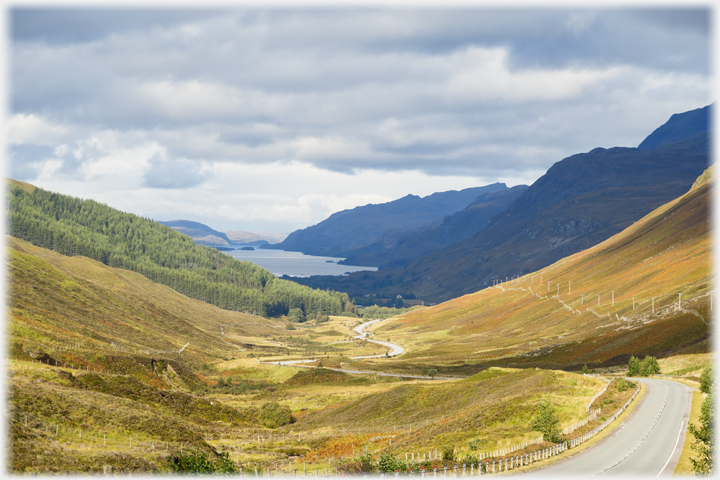
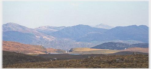
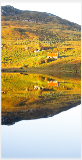
 Approaching Loch Maree from Glen Dochertie
The short drive across Scotland, from Inverness on the east to Gairloch on the west coast, is rewarded within the hour, first by the sight of Loch a' Chroisg that runs beside the road, and then by the opening out of Glen Dochertie as it descends to Loch Maree. Near the western tip of this, one of Scotland's most beautiful lochs, lies the village of Poolewe. The part of the road leading from the side of Loch Maree to the sea and Poolewe makes a detour round Sidhean Mor and the village of Gairloch. While the spelling of the names of the main communities is well established, conventions for features of the terrain are far from uniform, which, added to the problems of pronouncing the Gaelic, can be off-putting. Below I have indulged a little in excavating some of these names, I hope this is of interest - or easily skipped. This page has photographs from the road across to the west, maybe showing less of the beauty of Loch Maree than it should, as the shores of the loch are now thick with dense foreign trees making access difficult...
Approaching Loch Maree from Glen Dochertie
The short drive across Scotland, from Inverness on the east to Gairloch on the west coast, is rewarded within the hour, first by the sight of Loch a' Chroisg that runs beside the road, and then by the opening out of Glen Dochertie as it descends to Loch Maree. Near the western tip of this, one of Scotland's most beautiful lochs, lies the village of Poolewe. The part of the road leading from the side of Loch Maree to the sea and Poolewe makes a detour round Sidhean Mor and the village of Gairloch. While the spelling of the names of the main communities is well established, conventions for features of the terrain are far from uniform, which, added to the problems of pronouncing the Gaelic, can be off-putting. Below I have indulged a little in excavating some of these names, I hope this is of interest - or easily skipped. This page has photographs from the road across to the west, maybe showing less of the beauty of Loch Maree than it should, as the shores of the loch are now thick with dense foreign trees making access difficult...
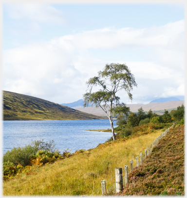 ...on the road before Loch Maree, this birch by Loch a' Chroisg, reminds us of the beauty of our native trees
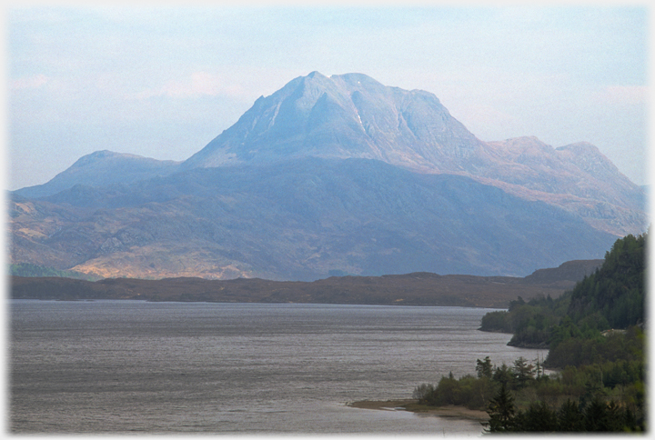
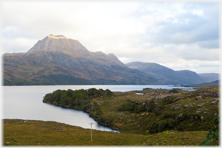
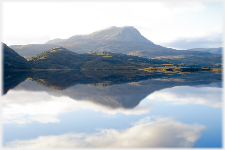
 Dominating the south east view, along the length of Loch Maree, is Slioch rising to
3,250 feet (980 metres), here in soft evening light
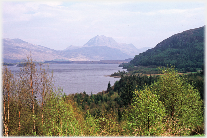
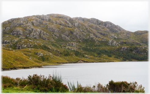
 This and the photo above show the loch side in 2005 before the trees had grown up obscuring the view...
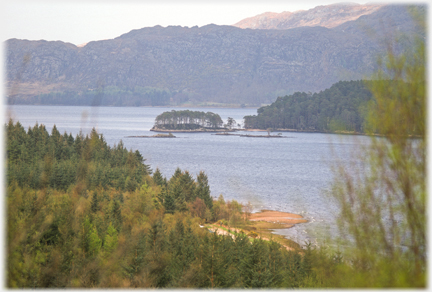
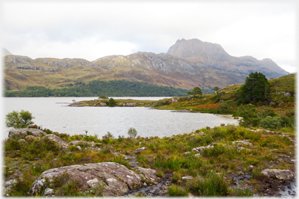 ...however, a contemporary image shows there are sections of the shore which can still be accessed
 The English name Slioch might be a corruption of the Gaelic sleagh - a 'spear'. Wikipedia thinks this may come from the hill seen from the northern side. However, that article gives the Gaelic version as being Sleaghach meaning 'armed with spears'. Looking at this, the southern side, one might imagine those pointed cliffs as being spears lying against the hill's flanks
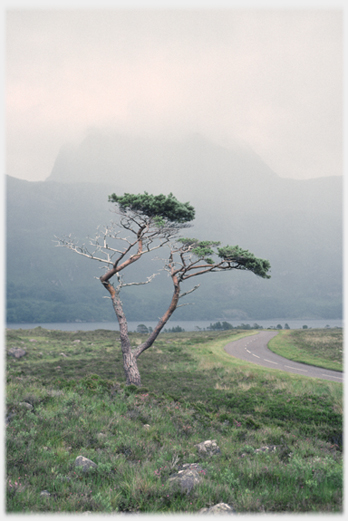 Proving that the Chinese have no monopoly on contorted pines; while Slioch hides its head
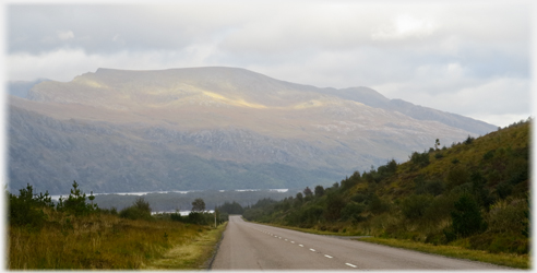 A streak of sunlight crosses Ben Lair to the north-west of Slioch
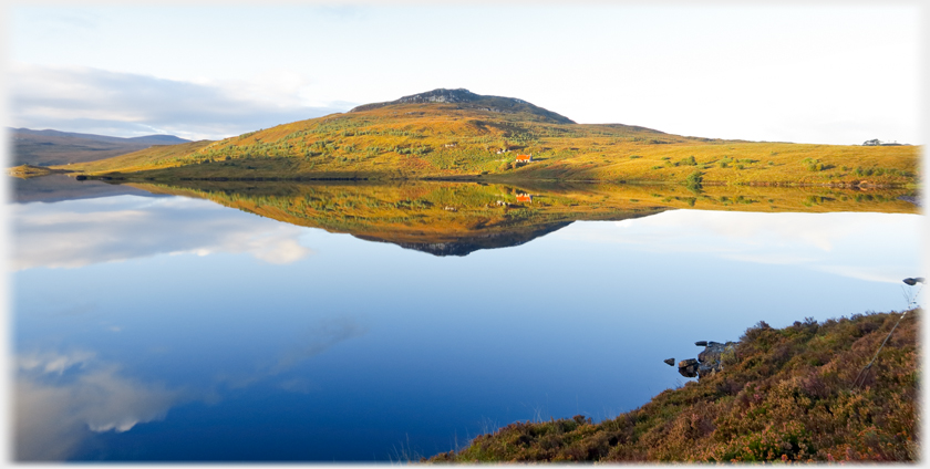
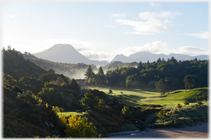
 Hills between Loch Maree and Gairloch with just that minimal touch of habitation that adds to the sense of space and isolation
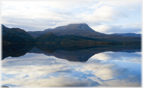
 Sun catches the top of Slioch. A most beautiful hill deserving these several photographs, a popularity also seen with travel agencies and tourist boards, but to show that there is no need...
 ...for Munros to offer such beauty, this fine nameless 230 metre hill rises in the morning sun from the land to the
right of the picture which does have a name - Na Doireachan - by Loch Bad an Sgalaig
 Still looking across Loch Bad an Sgalaig, but to the left, Creag an Fhithich keeps the morning cloud on its 737 metre top
 A closer look at that cottage shows an intact roof, such buildings are the object of much fantasy
 And left again, for the crags above the loch at the foot of
Meall a' Ghlas Leothaid
 Creag an Fhithich, now clear of mist, can be seen to be the northern end of Baosbheinn. Now the Gaelic obscurities take over, as renderings of this name vary, for example Bartholomew has Baeisliven Bus Bheinn, and none of them has an easy etymology
- maybe most likely is 'hunting hill'
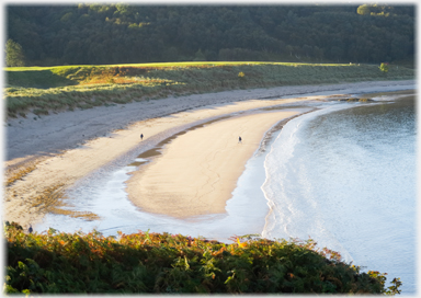 Gaineamh Mhor (great fine-sand) is the name of the beach just to the south of Gairloch village
A video clip panning from Charlestown, around Loch Gairloch, to Gairloch Village
Gaineamh Mhor (great fine-sand) is the name of the beach just to the south of Gairloch village
A video clip panning from Charlestown, around Loch Gairloch, to Gairloch Village
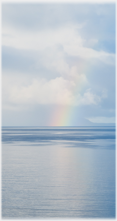 A rainbow dives into the sea leaving Skye just visible to the villagers of Gairloch...
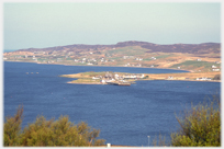
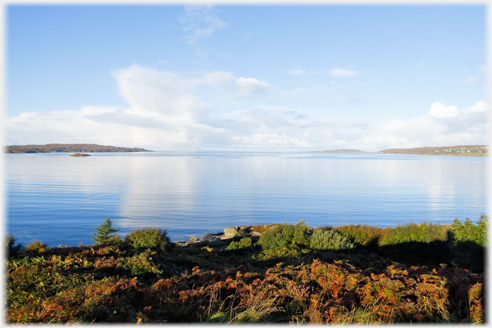 A general view of Loch Gairloch from beside the village
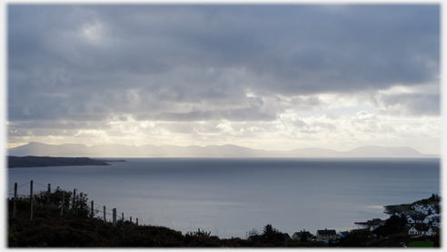 ...And a clearer image of Skye from the same viewpoint
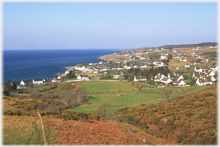 Gairloch. This name had emerged by the 1840s from the series of townships that lined Loch Gairloch (as opposed to the Gare Loch in Arglye) evidence of which dates back to the 1400s. The mid nineteenth century saw the first road built linking these communities by land to the rest of Scotland, at that time some 40 fishing boats worked from the Loch
 Same viewpoint, but maybe a commoner style of lighting!
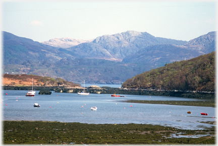 A view from Badachro Bay
of the hills behind Gairloch
A view from Badachro Bay
of the hills behind Gairloch
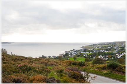
 The Charlestown and Kerrydale areas that lie just south of Gairloch village
Trailers...
The Charlestown and Kerrydale areas that lie just south of Gairloch village
Trailers...
 From Gairloch the road leads over the hill to
the next page
which has photos from Poolewe and Aultbea area
From Gairloch the road leads over the hill to
the next page
which has photos from Poolewe and Aultbea area
 The next page
of the Mosaic Section is headed 'Metaphor as Tension'.
The next page
of the Mosaic Section is headed 'Metaphor as Tension'.
Or go to the contents Go to the contents of the Mosaic Section. of the Mosaic Section.

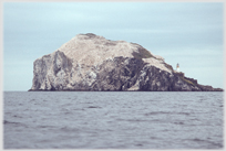 The last page had photos from the Bass Rock in the
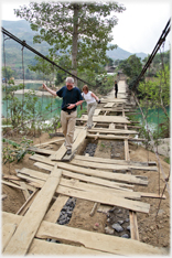
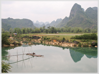 And this page on waterways in north-east Vietnam -
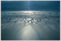 More shores - this page on north-west Iceland and Breiðavik
 ...guide to this site