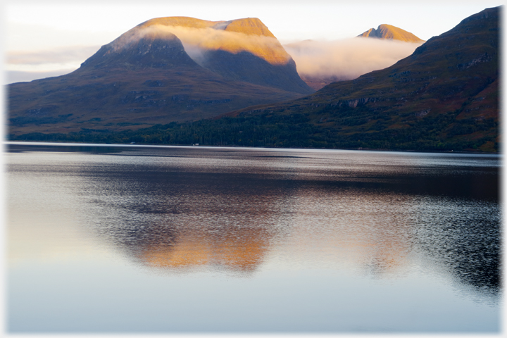
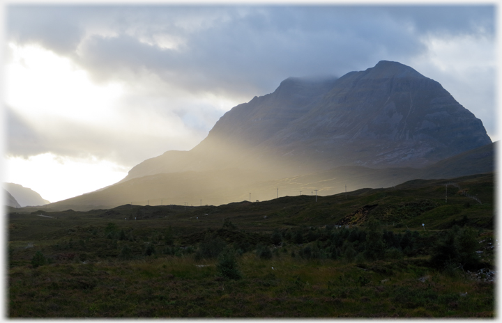
 The sun rising on Beinn Allign
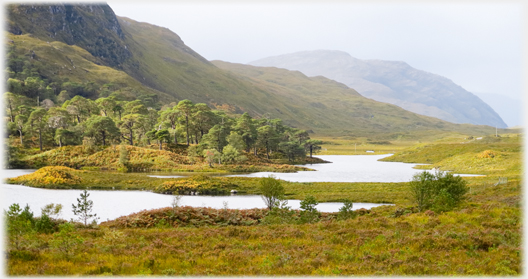
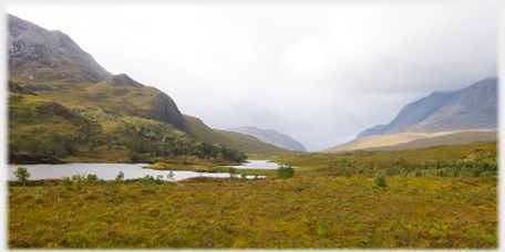
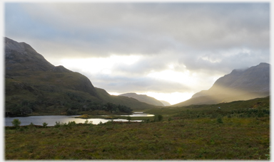
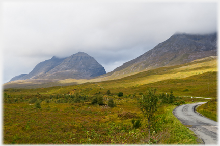
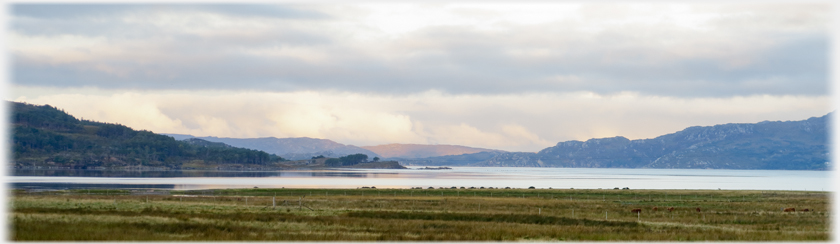
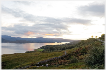
 The east entrance to Glen Torridon, from Kinlochewe, offers the soft banks of Loch Clair to the left of the road...
For many of us Torridon is the epitomay of the landscapes of Wester Ross, and indeed of the western coast of Scotlnd. At its western end Loch Toridon opens into the Inner Sound, the sea between Skye and the mainland, and through narrows, passing eastwards, it becomes Loch Shieldaig, which in turn becomes Upper Loch Torridon. The name continues applying to the river that comes from Glen Torridon, and enters the sea loch by Torridon village. Along the northern side of the Upper Loch and the Glen stand three magnificent Munros (Hills standing over 3,000 feet - 900 metres). Each has its own unique character. Below, these three hills, plus the lower Beinn na h-Eaglaisse which lies just to the south of the village, feature prominently.
Much of the page shows images which contrast differing light on the hills. A key part of the attraction of the area is this ever changing light which renders few pairs of photos, of the same view, alike. Written Gaelic names, like some of the hills, seem daunting in themselves, but the rules are in fact phonetic, although complex, having been developed systematically in Victorian times. Many letters are indicators, and not themselves pronounced.
The east entrance to Glen Torridon, from Kinlochewe, offers the soft banks of Loch Clair to the left of the road...
For many of us Torridon is the epitomay of the landscapes of Wester Ross, and indeed of the western coast of Scotlnd. At its western end Loch Toridon opens into the Inner Sound, the sea between Skye and the mainland, and through narrows, passing eastwards, it becomes Loch Shieldaig, which in turn becomes Upper Loch Torridon. The name continues applying to the river that comes from Glen Torridon, and enters the sea loch by Torridon village. Along the northern side of the Upper Loch and the Glen stand three magnificent Munros (Hills standing over 3,000 feet - 900 metres). Each has its own unique character. Below, these three hills, plus the lower Beinn na h-Eaglaisse which lies just to the south of the village, feature prominently.
Much of the page shows images which contrast differing light on the hills. A key part of the attraction of the area is this ever changing light which renders few pairs of photos, of the same view, alike. Written Gaelic names, like some of the hills, seem daunting in themselves, but the rules are in fact phonetic, although complex, having been developed systematically in Victorian times. Many letters are indicators, and not themselves pronounced.
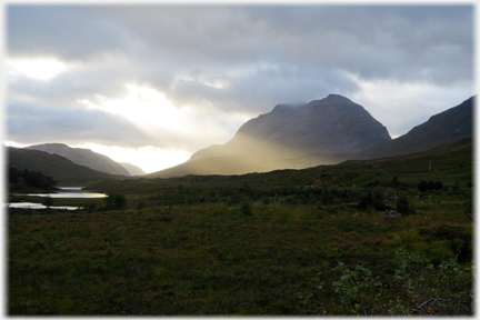
 ...softened further as a shower approaches
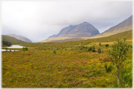
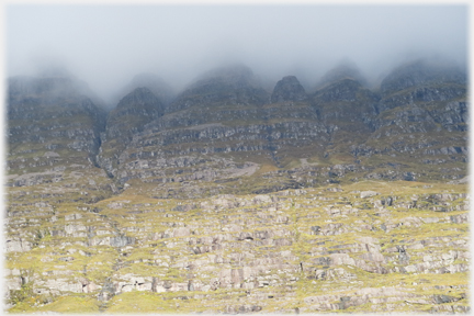
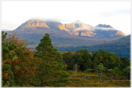
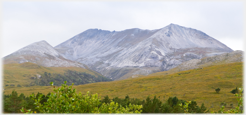 In contrast to the soft valley, the right of the road is guarded by a daunting inhospitable mass, the serrated crest of which gives it its Gaelic name Beinn Eighe - a cutter. The light colour of the hill is not a powdering of snow,
but the quartzite nature of the rocks
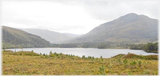
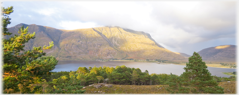
 Looking on down the glen the River Torridon points to Beinn na h-Eaglaisse, no doubt named for a one-time church. Beautiful open woods of birch and pine line the river's banks...
 ...the trees disappear as dusk falls,
and the shapes of the
hills take over A video clip which pans around the view near Loch Clair showing the hills that are captured individually below
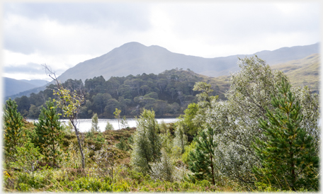
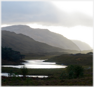
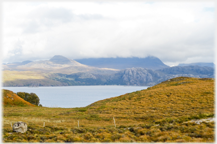
 The hill which keeps the loch company is Sgurr Dubh, fittingly meaning a conical hill of darkness
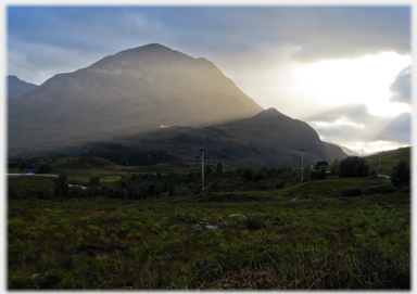
 An evening shot looking down the glen with Torridon's dominant hill, Liathach, (a bit like 'Lee-uch' with a Scots 'ch') appearing above the telegraph poles to the right
 Two views from one place, above in the morning...
 ...and this one taken in the evening
 And so to the eastern end of Liathach itself...
 ...emerging from the shadows to the morning light
 The spectacular hill, that sits above the village of Torridon, is Liathach - a name indicating its greyness. This link takes you to see a video of
drone shots
The spectacular hill, that sits above the village of Torridon, is Liathach - a name indicating its greyness. This link takes you to see a video of
drone shots
 - a touch vertiginous!
 The road winds down to Torridon and the sea, bringing...
 ...the complexity of Liathach's south face into full view
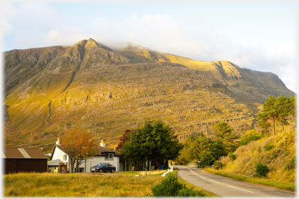
 Liathach from the south, with the village of Torridon at its feet, here mellow in the evening light, making its two mile ridge line look approachable. Looking at the video (linked above) will remove that illusion for most of us! The black line dropping from the centre high point is shown at a different angle just below...
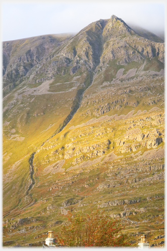 ...that innocent black line as seen from the village. These rocks are geologically complex, and range in age from the surface ones which are some 550 million years old, to the Lewisian bedrock that is about two billion years old and amongst the oldest known in the world
 The cleft again, here from the Shieldaig road and
bathed in warm light, but...
 ...a shift of a few hundred yards and a couple of hours and the scene is transformed
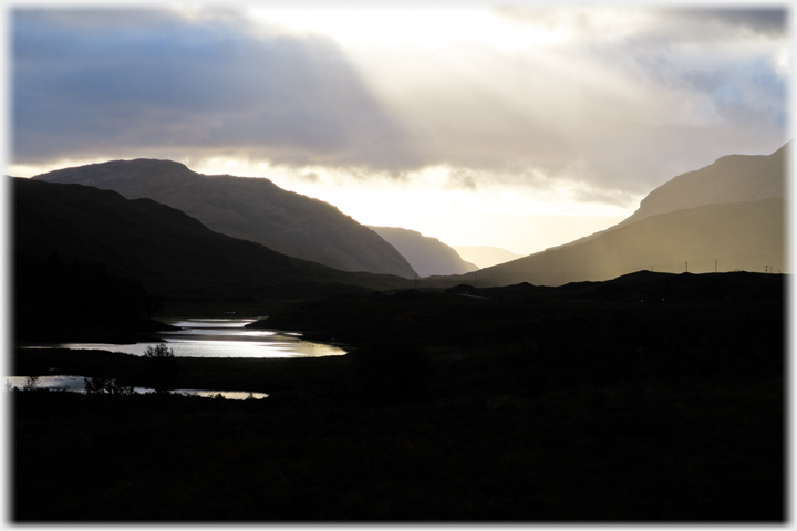
 Looking east towards Torridon, up the loch, the hills hide their heads in the clouds while the
lower slopes are modelled by the light
 Looking from Torridon to the west as dawn touches the far hills
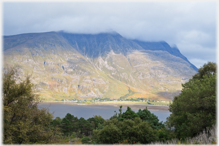
 Beinn Alligin lies west of Liathach. And just to its west is the village of Diabaig on the shores of the loch...
 ...barely visible in this photo looking across Loch Torridon; the houses are below the cleft cliffs
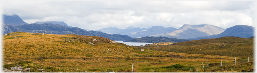
 Between Beinn Alligin and Diabaig village lies Loch Diabaigas Airde. On the horizon is Skye, on the far side of the Inner Sound
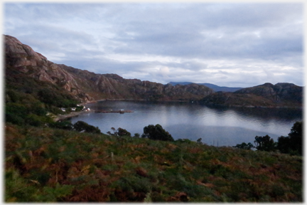
 Across to the islet (Chaoil) which marks the dividing line between the lochs of Shieldaig and Torridon
 Dusk drops on the circular harbour at Lower Diabaig. At one time the pier was the only link to the outside world
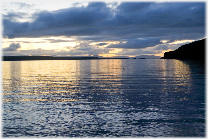 The final minutes of light as seen from the pier in Diabaig, Skye, as ever, forming the backstop
Trailers...
The final minutes of light as seen from the pier in Diabaig, Skye, as ever, forming the backstop
Trailers...
 The next page
of this section takes you out along the south shore of Loch Torridon.
The next page
of this section takes you out along the south shore of Loch Torridon.
 The next page
of the Mosaic Section is headed 'Power'.
The next page
of the Mosaic Section is headed 'Power'.
Or go to the contents Go to the contents of the Mosaic Section. of the Mosaic Section.

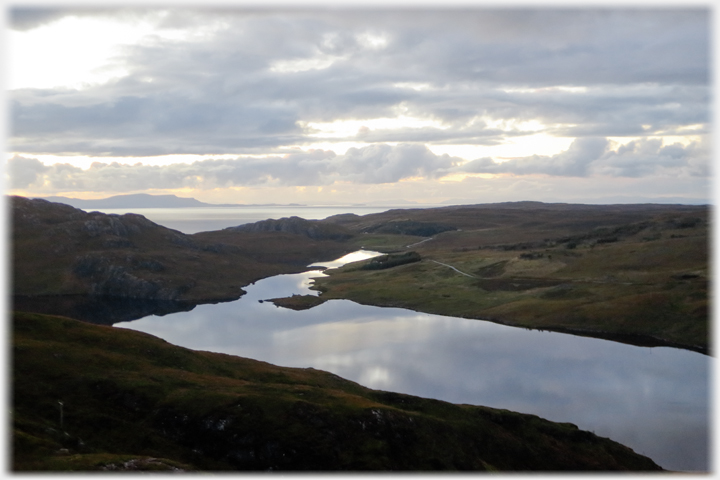
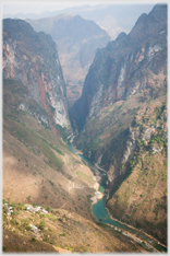
 The last page had photos from Red Point, on the north west corner of Loch Torridon
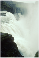
 A page with much newer rocks - Iceland was 'only' formed 50 million years ago
 ...guide to this site