|
|
Phăng Xi Păng to Sa Pa
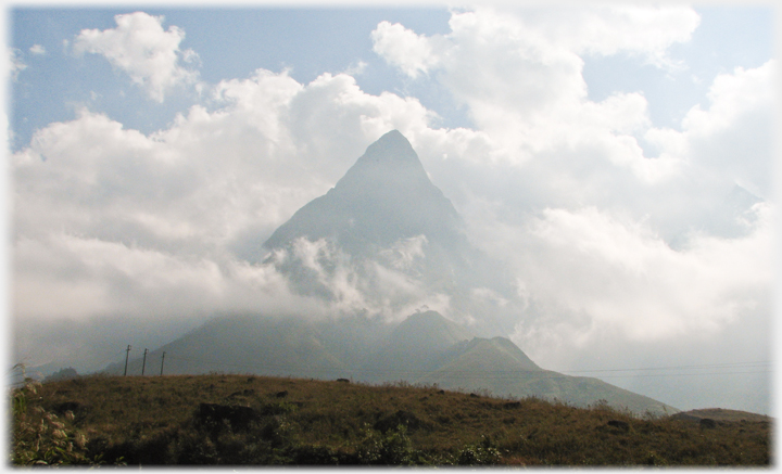 Mount Phăng Xi Păng
 is the highest mountain on mainland south-east Asia. It stands 3,148m (10,200ft) above sea level, and lies 5 miles (8 km) to the south-west of Sa Pa from where it can be seen when the clouds lift sufficiently. Trips from Sa Pa to the top of the mountain are arranged, this is strictly for the fittest visitors and even for such people takes three days.
Mount Phăng Xi Păng
Mount Phăng Xi Păng is the highest mountain on mainland south-east Asia. It stands 3,148m (10,200ft) above sea level, and lies 5 miles (8 km) to the south-west of Sa Pa from where it can be seen when the clouds lift sufficiently. Trips from Sa Pa to the top of the mountain are arranged, this is strictly for the fittest visitors and even for such people takes three days.
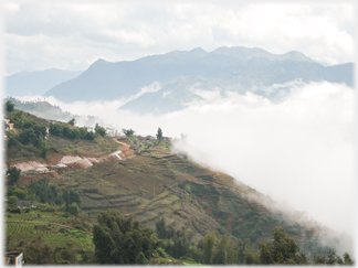
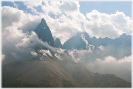 Mount Phăng Xi Păng seen as part of its range of hills
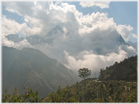 Mount Phăng Xi Păng from the road outside SaPa, in its most common aspect - head in the clouds
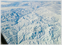
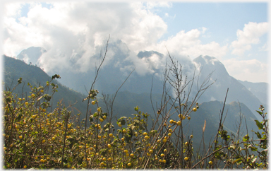 The Phăng Xi Păng range (invisible) from the north
The road winds its way down from the pass nearest Phăng Xi Păng towards Sa Pa offering spectacular views all the way. Sa Pa itself is set on a hill with wide valleys extending southwards.
The Phăng Xi Păng range (invisible) from the north
The road winds its way down from the pass nearest Phăng Xi Păng towards Sa Pa offering spectacular views all the way. Sa Pa itself is set on a hill with wide valleys extending southwards.
 Evening clouds gather in the valley near Sa Pa
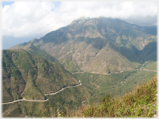 The road from Sa Pa to Lai Châu wending its way around the mountains
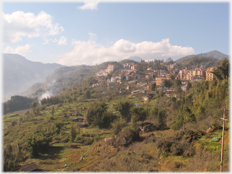 Like the British in India, the French during their occupation of Vietnam wanted a cool retreat from the heat, and so the hill station of Sa Pa was built. It is about 1,500m (5,000 ft) above sea level
 As the road descends from the higher mountains, where few people live, the hillsides become embroidered with a tracery of paddy terracing. Here it is winter and just the residue stubble of the previous season's growth is visiable
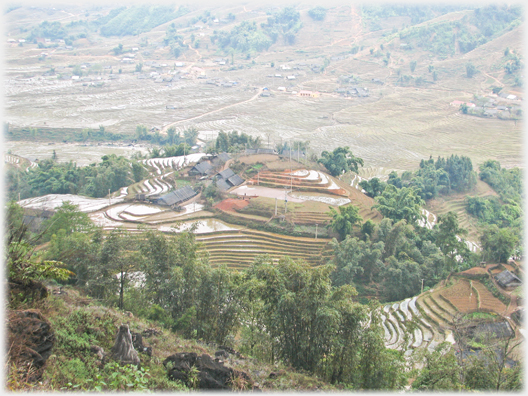
 A view of a valley near Sa Pa
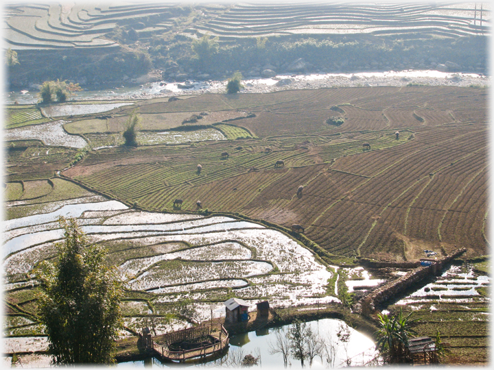
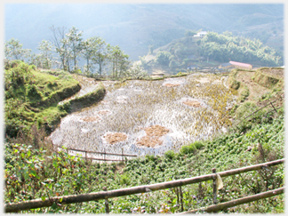
 A hilltop village, with its closely clustered houses amongst the terracing, looks out over the valley where the houses are spaced out with fields between them
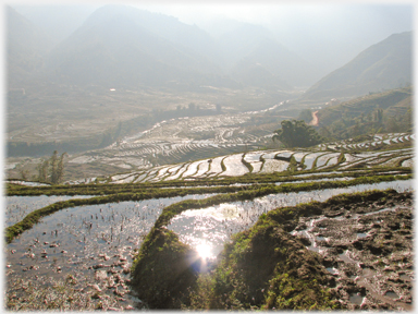
The image above shows many features of rural life in the north west of Vietnam. In the foreground is a fishpond, to the right and at the top of the picture are the terraces so typical of the steep sided hills of the north. These are often extremely extensive and represent hundreds of years of careful construction to guide the water downwards, irrigating every field, on every level, all the way. Below, in the river valley, the fields are flatter and the stubble is being grazed; although often the cattle can be seem high up the hills undeterred by vertiginous slopes.
A hilltop village, with its closely clustered houses amongst the terracing, looks out over the valley where the houses are spaced out with fields between them
The image above shows many features of rural life in the north west of Vietnam. In the foreground is a fishpond, to the right and at the top of the picture are the terraces so typical of the steep sided hills of the north. These are often extremely extensive and represent hundreds of years of careful construction to guide the water downwards, irrigating every field, on every level, all the way. Below, in the river valley, the fields are flatter and the stubble is being grazed; although often the cattle can be seem high up the hills undeterred by vertiginous slopes.
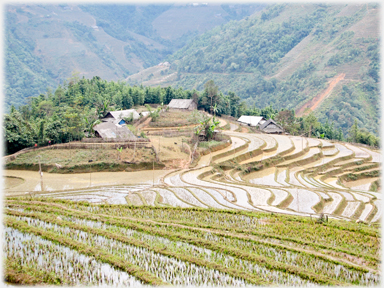 A hamlet perches above the valley among the terraces
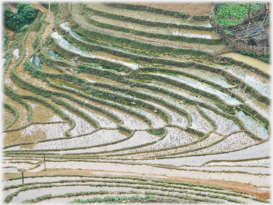 The intricate terraces characteristic of northern Vietnam
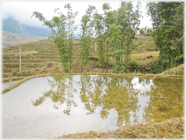
 Here a little flat ground forms a field on the steep hillside
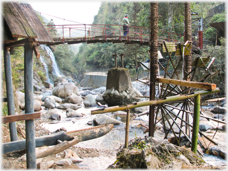 This water wheel being used to pound grain
While water wheels are widely used to assist irrigation, there are other uses include pounding. Water is lifted to a bamboo shoot which delivers it into the trough of a grain pounder and so raise a hammer, the water then falls out, and the hammer descends.
This water wheel being used to pound grain
While water wheels are widely used to assist irrigation, there are other uses include pounding. Water is lifted to a bamboo shoot which delivers it into the trough of a grain pounder and so raise a hammer, the water then falls out, and the hammer descends.
 Flatter areas of the terraces give space for wider fields with bamboos; bamboos which provide shade, shelter, food, implements and housing materials
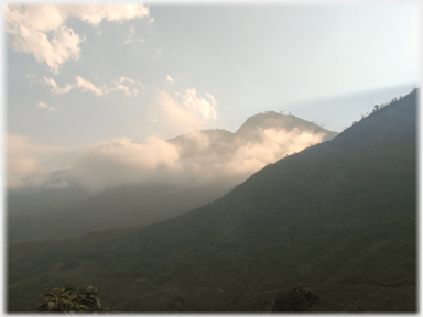 The setting sun catching the clouds forming between the hills
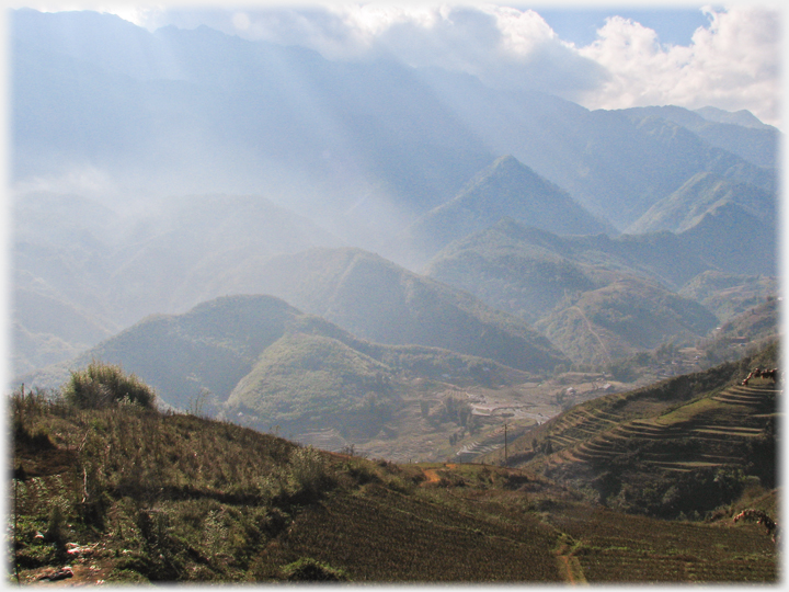 Looking up the main valley in the direction of Phăng Xi Păng from Sa Pa
The next page
takes you to the road's destination, the (maybe a little too much of a) tourist town - Sa Pa .
Looking up the main valley in the direction of Phăng Xi Păng from Sa Pa
The next page
takes you to the road's destination, the (maybe a little too much of a) tourist town - Sa Pa .

Saturday 13th August 2016

Go to the Picture Posting contents page
Return to the top
|
|
 The last page was about Logan Gardens in the south of Scotland with its array of tropical plants
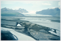 Go to a page on some really wild country in southern Iceland and the Vatnajokull Glacier
 Go to a page with some other high mountains - in Eastern Turkey