|
|
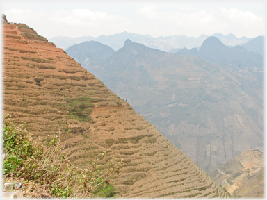
Mã Pì Lèng's Twin Peaks
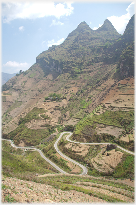 Twin peaks with the road to China looping below
It is only some 20 miles (30 km) through the whole pass, but most visitors demand a half day for the journey while they repeatedly stop, walk, photograph and marvel at the scale of the unfolding scene. These shots are taken in the last turn of the pass as it descends to the next town Mèo Vạc
Twin peaks with the road to China looping below
It is only some 20 miles (30 km) through the whole pass, but most visitors demand a half day for the journey while they repeatedly stop, walk, photograph and marvel at the scale of the unfolding scene. These shots are taken in the last turn of the pass as it descends to the next town Mèo Vạc
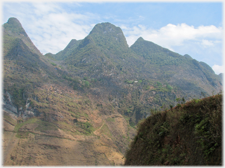
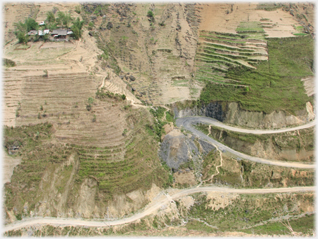 The loops of the road from the other angle showing the house on the hillside
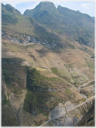
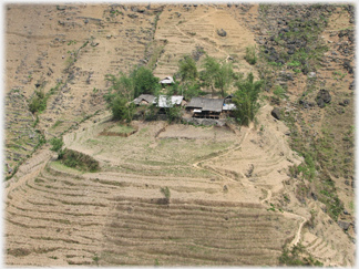 The house, pictured right, and its fields
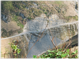 The grey fallen rock forms a scree below the road along which a truck nervously creeps
Roads in these hills, 'hairpinning' their way up 60 degree slopes are constantly subject to landslips. The picture to the right shows plainly a mass of loose rock which, when it fell would have been taken the road with it - avalanches like this are why tourists do not take these roads in the rainy season!
The grey fallen rock forms a scree below the road along which a truck nervously creeps
Roads in these hills, 'hairpinning' their way up 60 degree slopes are constantly subject to landslips. The picture to the right shows plainly a mass of loose rock which, when it fell would have been taken the road with it - avalanches like this are why tourists do not take these roads in the rainy season!
 About half way down the slope of the hill is a black dot, the dot is repeated to the right, and shown below
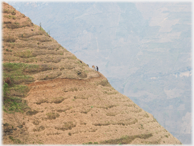 Here the dot of the last image becomes a ploughman
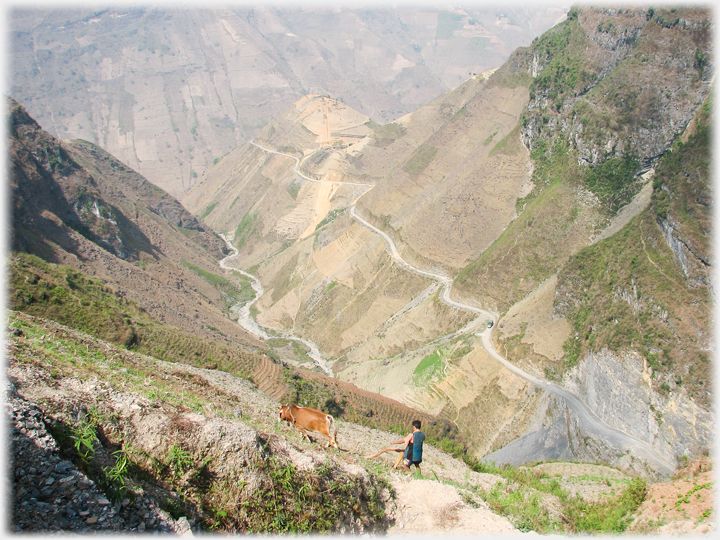
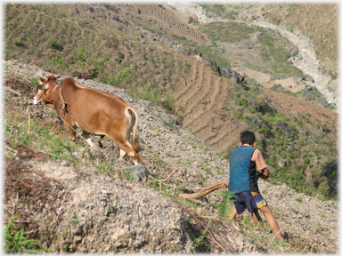 The man, his plough and the ox
These four images show a local farmer at work. The background for the lines of the terracing is the far side of the gorge - 4 or 5 miles away. Below he is seen from above and the background is the side valley where he is ploughing.
The man, his plough and the ox
These four images show a local farmer at work. The background for the lines of the terracing is the far side of the gorge - 4 or 5 miles away. Below he is seen from above and the background is the side valley where he is ploughing.
 And here he is in context. Above and to the right of his head on the road is a 40 ton truck
 A twisted shot, hoping to show both the road and the karsts next to the twin peaks
 The image above and to the left show the karsts beside the twin peaks that stretch away from the road. Just discernible in these images are white flecks among the rocks, these are houses finding a foothold like the
village shown
three weeks ago.
The image above and to the left show the karsts beside the twin peaks that stretch away from the road. Just discernible in these images are white flecks among the rocks, these are houses finding a foothold like the
village shown
three weeks ago.
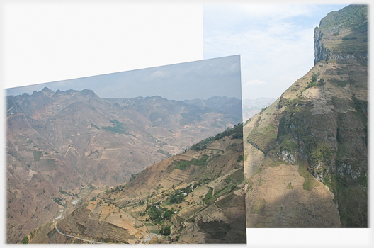
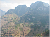
 The twin peaks from across the valley - the slope continues downwards for another 3,000 feet, the composite picture below tries to convey the scale of the view
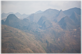 Dim in the misty atmosphere, karsts squat on the plateau - seen again below
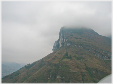
 It needs two photographs from different angles to show the full extent of the main buttress below the twin peaks - the upper section is shown below in less clement conditions
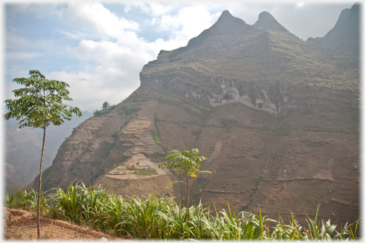
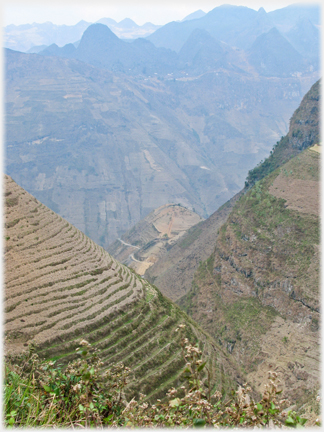 As the main pass is left behind the hillsides become fully clothed in terraces
The weather in Vietnam is challenging in many ways, conspicuous here is the normal mist which veils landscapes, sometimes descending as cloud, but often obscuring detail
As the main pass is left behind the hillsides become fully clothed in terraces
The weather in Vietnam is challenging in many ways, conspicuous here is the normal mist which veils landscapes, sometimes descending as cloud, but often obscuring detail
 Not so different from Scottish hills in one respect; the clouds come down
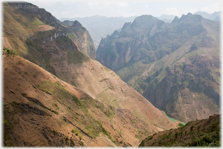 A last view backwards into the pass: the road cuts at the very top left, the river is a bright turquoise splash bottom right, and the the main gorge appears upper left centre
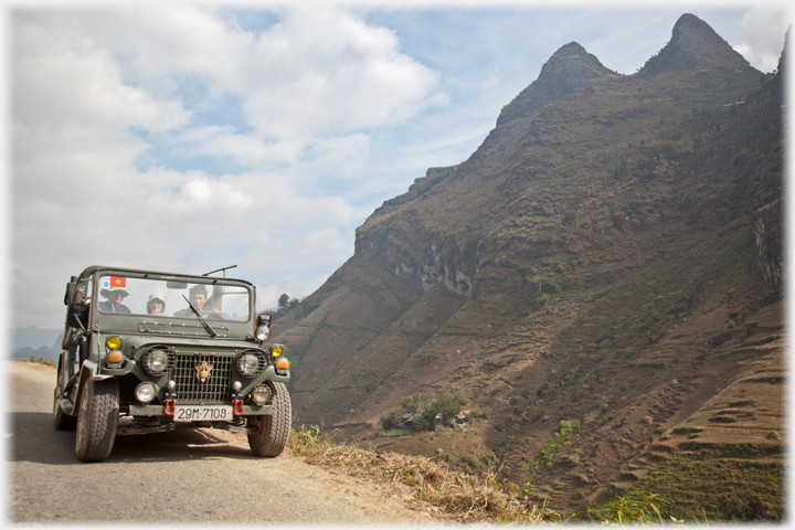 The jeep and visitors leaving the Mã Pì Lèng Pass below the twin peaks
The next page
retraces our steps back to the District capital, Đồng Văn Town, leaving the rugged wildernesses behind and introducing the town and its people - mostly busy with their market.
The jeep and visitors leaving the Mã Pì Lèng Pass below the twin peaks
The next page
retraces our steps back to the District capital, Đồng Văn Town, leaving the rugged wildernesses behind and introducing the town and its people - mostly busy with their market.
Saturday 24th September 2016
Go to the Picture Posting contents page
Return to the top
|
|
 Last week's page was about the road through the pass
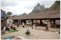
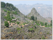 A village in the Mã Pì Lèng Pass
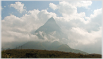 Vietnam's highest peak - Phăng Xi Păng